More Marsh, Less Trail?
A bold vision for the future of Petaluma’s most popular river park
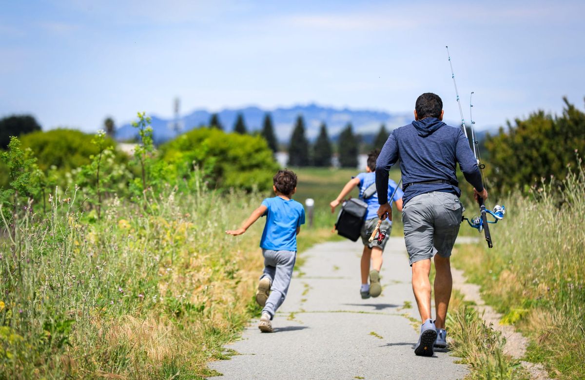
Shollenberger Park in southeast Petaluma, visited by hundreds of community members each day, sits at the heart of an ambitious, long-term restoration vision released in early February by the San Francisco Estuary Institute (SFEI). The goal is to improve the resilience and ecological functioning of three city-owned wetlands covering nearly 500 acres – but it could also mean the end of one of Petaluma’s most beloved riverfront paths.
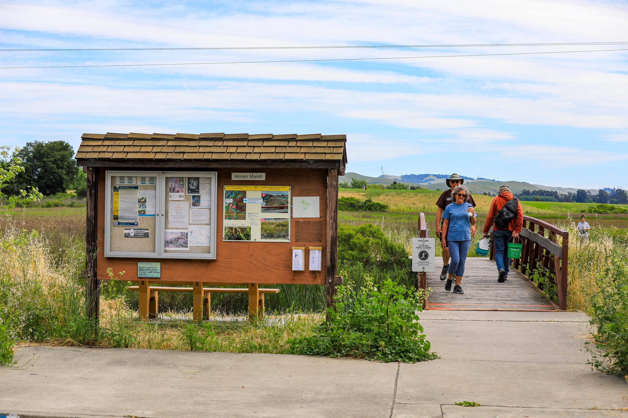
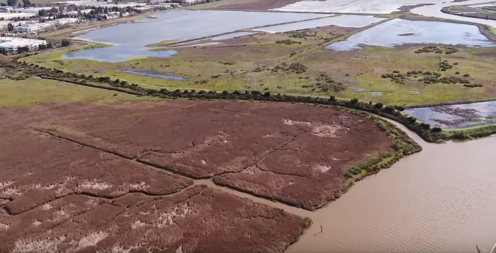
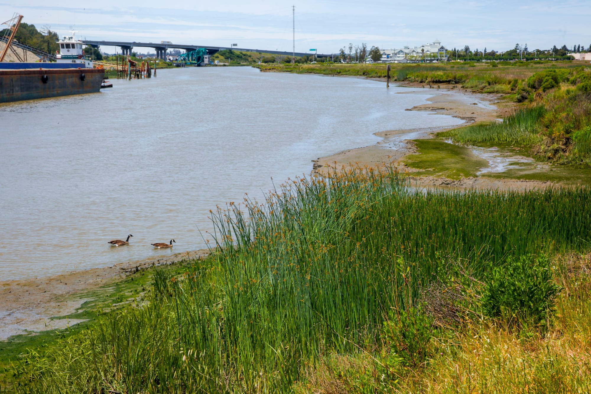
Rising tides are coming for Shollenberger, and even sooner for the lower-lying marsh to its north, Alman Marsh, where a one-mile trail linking Shollenberger to the Petaluma Marina floods during very high tides. A third parcel to the south, Gray’s Marsh, is already swimming in bay waters.
“We’re going to lose Alman Marsh for sure, and will lose parts of Shollenberger Park between now and 2050 to 2075,” said Petaluma City Councilmember and Petaluma Wetlands Alliance Vice President John Shribbs. “We’re going to lose them to sea level rise anyway, so we might as well start preparing now.”
The Problem
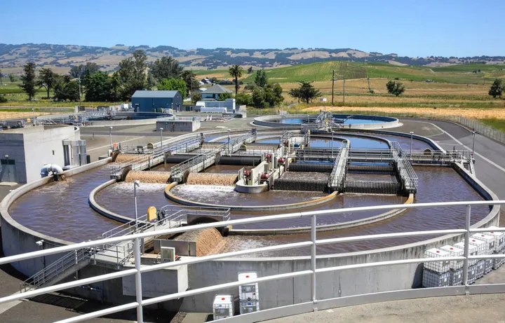
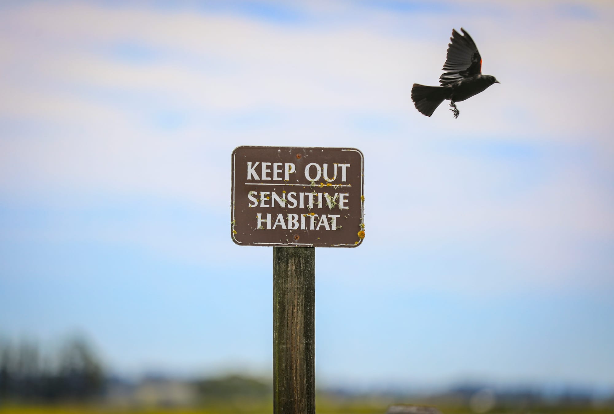
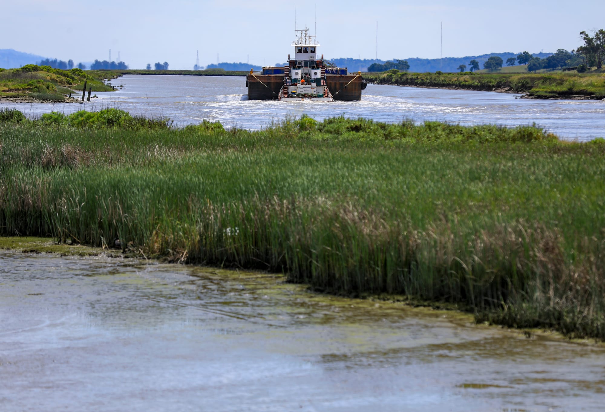
Although Shollenberger contains a seasonal wetland that attracts resident and migratory birds, it is not a functional tidal marsh. Ringed and disconnected from the Petaluma River by an earthen levee, the park was constructed and continues to function primarily as a disposal site for mud dredged from the river.
Since opening in 1995, Shollenberger Park has become one of Petaluma’s most cherished public spaces, where community members, special events, abundant wildlife, and the perennial ebbs and flows of our namesake slough converge.
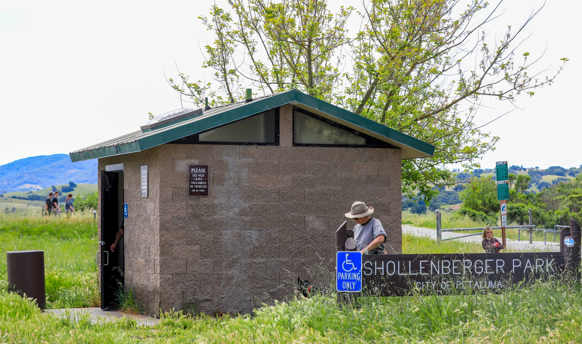
But as sea level rise maps in the new report reveal, the site’s future for both recreation and dredge disposal is at risk. The existing levee is sufficient to hold back the river itself for decades to come, but groundwater rise – the increasing elevation of the subsurface water table caused by sea level rise – threatens to impact the lower, eastern half of the park, including near the parking lot and bathrooms.
More urgently, both Alman and Gray’s marshes will be largely submerged beneath daily high tides with 1.6 feet of sea level rise, according to the latest projections from Petaluma-based nonprofit Point Blue Conservation Science in partnership with the U.S. Geological Survey.
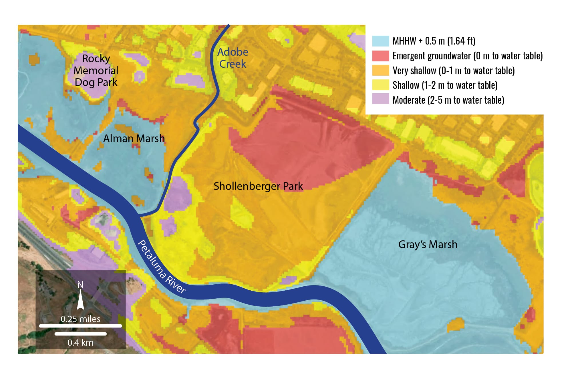
If nothing is done, this could occur in the latter half of the century, Shribbs noted. That would be bad news for the hundreds of residents that use these parks and trails every day, and even worse for the businesses, buildings, roads, and other infrastructure located immediately behind all three wetlands.
Marsh Power
Healthy marshes not only buffer high water but actively migrate with it. Supplied with sufficient “sediment,” as scientists call the silt suspended in our waterways, a tidal marsh can keep pace with modest sea level rise. At the very least, it’s more resilient and ecologically sound than any levee or seawall – and typically more cost-effective.
That’s why the report’s authors, led by SFEI senior scientist and Petaluma resident Scott Dusterhoff, have proposed to restore all three parcels as part of one grand plan. It would involve redistributing previously placed dredge spoils; strategically placing new mud from future dredges; and reconnecting Adobe Creek, a steady source of sediment from way up on Sonoma Mountain, to its historic floodplain on Alman Marsh.
“The real impetus for this project was getting creek sediment directly onto the marsh,” Dusterhoff said. “Other elements are focused on increased Petaluma River and bay sediment supply as time goes on. As sea level continues to rise and these marshes start to get inundated more frequently, they're going to [receive more] sediment. And so we wanted to set the landscape up to be able to benefit from that.”
The Solution
Here’s how the restoration process could work – at least as currently envisioned. Construction would happen in two phases: a near-term phase focused on restoring Alman and Gray’s marshes in the coming decades, and a long-term phase that would completely reimagine Shollenberger Park in the latter half of the century.
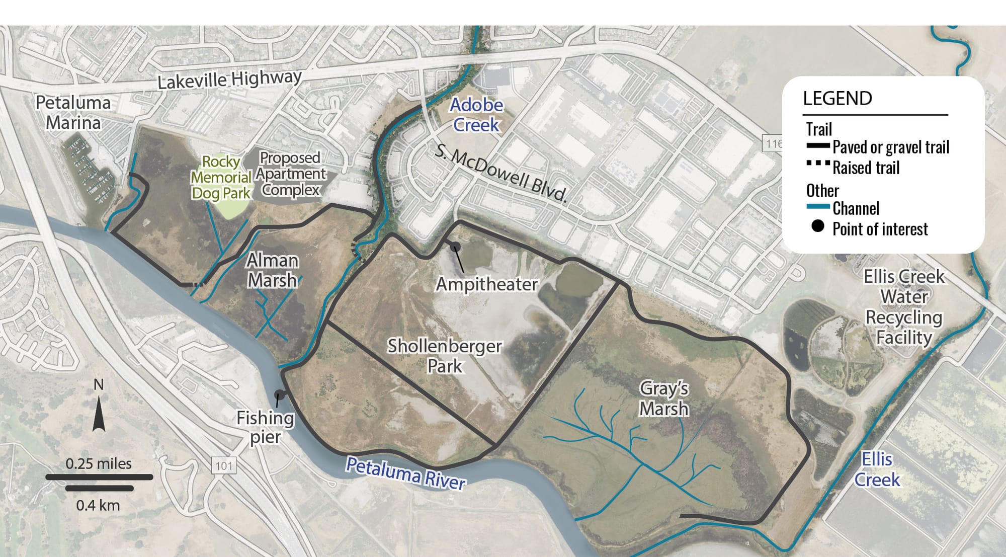
This would include removal of most of the existing levee and the 2.15-mile loop trail that sits atop it. A gravel path on the inland edge of the park would remain, connecting to the Ellis Creek Water Recycling Facility as it does now. Elsewhere, boardwalks would be built over the newly restored marsh leading to a fishing pier on the river, as well as across the middle of the marsh past a new seasonal pond – but not along the riverfront like today.
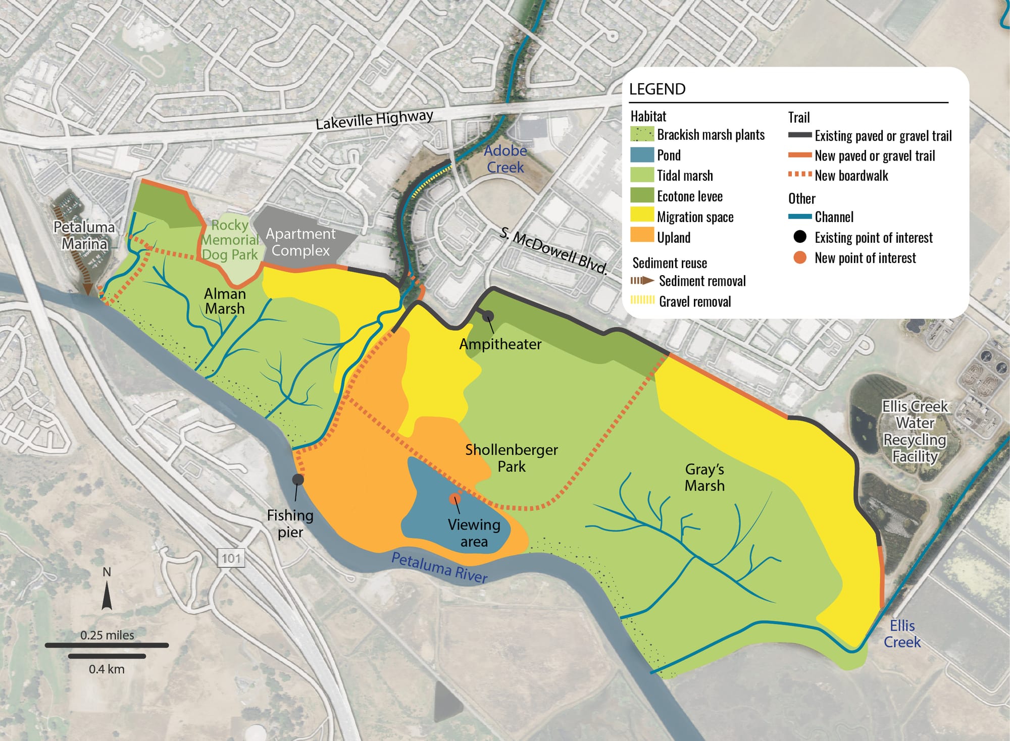
Yet this is just one vision for the future: an idea, not a plan. “A huge part of this work is really just coming together and imagining what's possible on the landscape,” said SFEI watershed scientist Emma Sevier, the report’s lead author. “And then it'll be, you know, the future studies and permitting, and all of the steps down the line which really bring it to life.”
The project is already years in the making. In 2015, the California State Coastal Conservancy released a 250-page report titled “The Baylands and Climate Change” to guide wetland restoration efforts around the San Francisco Bay for decades to come.
“The number-one action from that report was to reconnect our watersheds to our marshes to bring in that natural sediment supply,” Dusterhoff said. “So this is something that we're really looking at around the region, trying to find these opportunities for connecting watersheds to their baylands.”
Next Steps
In 2022, the City of Petaluma received authorization from the United States Army Corps of Engineers, which oversees dredging of the Petaluma River, to proceed with a plan for restoring Gray’s Marsh through the beneficial reuse of dredged material, said Chelsea Thompson, Petaluma’s director of water resources and utilities.
The recently released report from SFEI expands this vision to encompass all three marshes. In order to proceed, the city will need to complete a feasibility study including additional research and public outreach, estimated to cost approximately $3 million, Thompson said.
The Army Corps denied the city’s initial request to fund the study earlier this year, and now the city is looking at the Corps’ 2028 budget. It is also eyeing California’s Proposition 4, a $10-billion bond passed by voters in November 2024 to fund climate, environmental, and water infrastructure projects.
Stephanie Bastianon, executive director of the Friends of the Petaluma River, led a pair of public outreach events in preparation of the SFEI report. She said its vision for a restored Shollenberger Park and adjoining marshes is critical to the future of the city.
“Petaluma is really a low-lying town,” she said. “We have this river that comes in that's tidal, and we expect that sea level rise is going to impact Petaluma. Petaluma is really lucky that we have one of the largest ancient tidal marshes in California … and what the marsh is doing is allowing water to spread out over this huge space.”
While the city awaits further funding, no additional public events are planned. Going forward, outreach will be a critical part of the process, Bastianon said, including “educating people about what function the marsh plays.”
As far as potentially losing Shollenberger’s popular riverfront trail? “It's something that we have to weigh as a community,” she said.
Correction 5/16/26 9:09 a.m.: John Shribbs' position with Petaluma Wetlands Alliance was corrected from president to vice president.
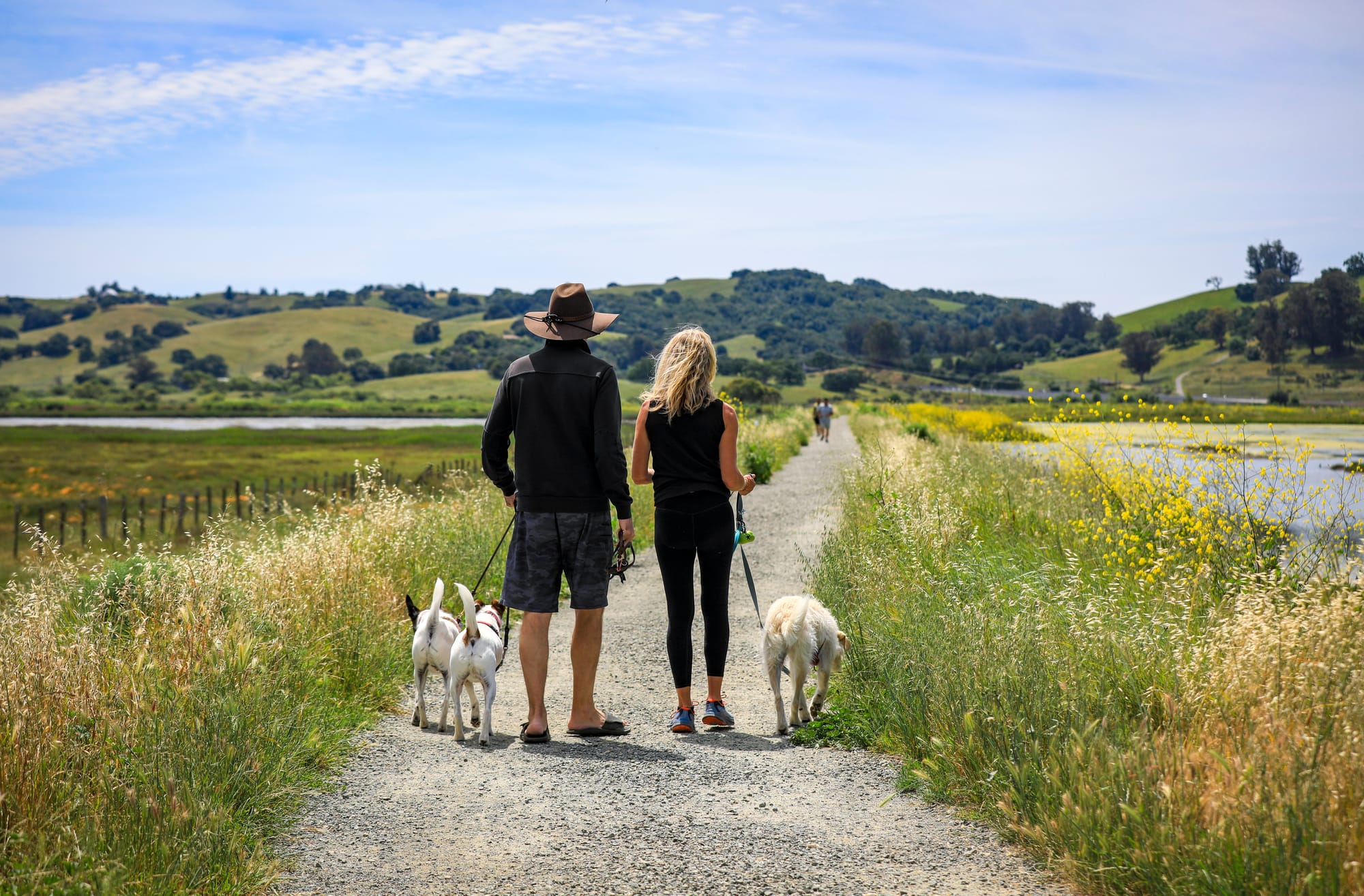
The scenic, levee-top loop trail at Shollenberger Park attracts runners, walkers, and bicyclists from across Petaluma. (Sunday, April 19, 2026. CRISSY PASCUAL/PETALUMA VOICE ©2026)